Migrating Cyclones Pose New Threat
Coastal areas that would not expect to be hit by violent hurricanes or typhoons face a growing threat of devastation as scientists discover that tropical cyclones are moving further north and south.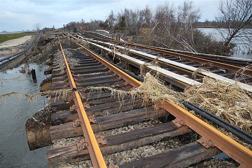
By Tim Radford, Climate News NetworkThis piece first appeared at Climate News Network.
LONDON — Tropical cyclones — hurricanes in the Caribbean, typhoons in the South China Sea — are moving further north and south, threatening to create new havoc in unsuspecting coastal areas.
New research published in the journal Nature reveals that, on average, the storms have been migrating towards the poles at the rate of 53 kilometres a decade in the northern hemisphere, and 62 kilometres in the southern.
This means that landfalls that in the past that would not have expected violent storms will become increasingly at risk — “with obvious effects on coastal residents and infrastructure”, the paper says.
Jim Kossin, an atmospheric research scientist at the US National Oceanic and Atmospheric Administration (NOAA), and colleagues looked at data for the last 30 years and measured the latitudes as which storms reached their peak intensity. They found an uneven but measurable shift of around half a degree of latitude every 10 years.
The news makes sense, as researchers have previously identified a steady “expansion” of the tropics as a result of global warming.
More hostile
“We’ve identified changes in the environment in which the deep tropics have become more hostile to the formation and intensification of tropical cyclones, and the higher latitudes have become less hostile,” Dr Kossin said. “This seems to be driving the poleward migration of storm intensity.”
Kerry Emanuel, professor of atmospheric science at the Massachusetts Institute of Technology and co-author of the report, said: “The trend is statistically significant at a pretty high level.”
Another of the report’s authors, Gabriel Vecchi, also of NOAA, said: “Now we see this clear trend, it is crucial that we understand what caused it — so we can understand what is likely to occur in the years and decades to come.”
There seems to be an ideal ocean surface temperature of between 28°C and 30°C at which tropical cyclones are most likely to happen. As temperate seas begin to warm, the hazard zone widens.
Not prepared
The superstorm Hurricane Sandy, which devastated New York in 2012, slammed into a coast not prepared either for the force of the wind or for the storm surge that washed through the coastal structures.
But storms are capricious, and notoriously hard to map accurately, so the researchers decided that the surest guide to any pattern of migration would be the latitude at the point of maximum intensity.
They identified regional differences, but found that every ocean basin except the northern Indian Ocean had experienced such a change. Changes in vertical wind shear — which plays a role in cyclone formation — may be involved.
The incidence of cyclones in the tropics actually fell between 1982 and 2012. The suspicion is that although tropical cyclones may become more intense in a warmer climate, it may also be harder to generate them.
Your support matters…Independent journalism is under threat and overshadowed by heavily funded mainstream media.
You can help level the playing field. Become a member.
Your tax-deductible contribution keeps us digging beneath the headlines to give you thought-provoking, investigative reporting and analysis that unearths what's really happening- without compromise.
Give today to support our courageous, independent journalists.
 The Filipina writer talks about her passion for literature, the influence of poet Kenneth Rexroth and adapting "The Gangster of Love."
 Margaret Atwood's classic dystopian novel is a recipe book for how to create a hellish society. It's also a recipe book for how to resist.
 New scientific reports highlight yet again the threats that climate change and rising temperatures are posing for many species.
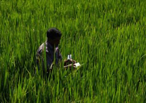 Nepali farmers are finding that environmentally friendly cultivation methods increase yields -- and also help them adapt to rising temperatures and increasingly erratic rainfall.
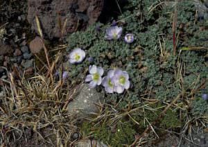 In just two centuries, many plant species have scrambled 500 meters up the Andes in search of cooler temperatures.
 Human-induced climate change adds to threats vertebrates face from hunting and habitat loss, as researchers warn that modern extinction rates are exceptionally high.
You need to be a supporter to comment.
There are currently no responses to this article.
Be the first to respond.