Gulf Oil Workers Evacuate Rigs Ahead of Storm
Oil-rig operators in the Gulf of Mexico announced Thursday that they would evacuate workers, and a flash-flood watch was issued for New Orleans ahead of a slow-moving storm system that could develop into a cyclone or even a hurricane. (more)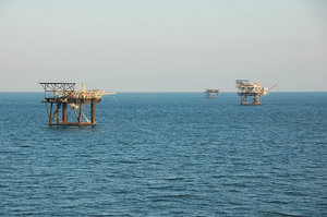
Oil-rig operators in the Gulf of Mexico announced Thursday that they would evacuate workers, and a flash-flood watch was issued for New Orleans ahead of a slow-moving storm system.
The storm front stretches from offshore Louisiana to the Florida panhandle, and is expected to sit in the Gulf of Mexico for a couple of days before making landfall, likely somewhere in Texas, officials said.
Official weather watchers said the storm has a 70 percent chance of becoming a tropical cyclone in the next 48 hours, and a 30 percent chance of becoming a Category 3 hurricane. –BF
Your support matters…Bloomberg via San Francisco Chronicle:
At AccuWeather Inc., in State College, Pennsylvania, meteorologists forecast “that this will be an extensive, slow- moving system, capable of affecting the same area for days with downpours, stormy seas and rough surf conditions,” Alex Sosnowski, expert senior meteorologist, said on the company’s website. Ten to 20 inches (25 to 51 centimeters) of rain may fall on the north-central coast, he said.
The National Weather Service issued a flash-flood watch for New Orleans through the weekend.
BP said today it will remove all workers from Gulf platforms by tomorrow. The company yesterday began removing more than 500 non-essential workers from some platforms in the Southern Green Canyon area, according to a message on the company’s hurricane hot line.
Independent journalism is under threat and overshadowed by heavily funded mainstream media.
You can help level the playing field. Become a member.
Your tax-deductible contribution keeps us digging beneath the headlines to give you thought-provoking, investigative reporting and analysis that unearths what's really happening- without compromise.
Give today to support our courageous, independent journalists.
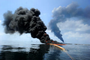 With his reelection at stake, Barack Obama made a series of decisions to control the disaster. It's clear now just how calamitous they were.
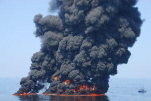 A new probe finds Louisiana has failed to pursue millions in remediation for spills—money environmental groups say they desperately need.
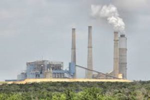
 A batch of corporate boards filled with sociopaths are knowingly killing us all. But one thing could end their murderous streak.
 In a congressional district where voters rely on fossil-fuel jobs, it’s not easy, but it's absolutely essential.
 A new investigation finds a range of industries were able to successfully mask their sponsorship of political ads on the social network.
It’s been going on since 2004, with no end in sight.
A new investigation finds a range of industries were able to successfully mask their sponsorship of political ads on the social network.
It’s been going on since 2004, with no end in sight.
You need to be a supporter to comment.
There are currently no responses to this article.
Be the first to respond.